
Living in Place and The Genius Loci

The concept of “Living in place” is derived from the definition of bioregionalism and has emerged as a new way of connecting to the land and creating a healthy relationship with community, our food, health care and life in general. The term ‘bioregionalism’ was coined by Allen Van Newkirk in the 1970’s. He founded the Institute for Bioregional Research and described a bioregion as “biographically interpreted culture areas…” In other words, he was identifying the inextricable connection between human life, health, culture and the ecology of the land. Land-based activist from Northern California, Peter Berg, further developed the concept as an element of the environmental movement. This movement began as a reaction to the industrial expansion and globalization monoculture that was burgeoning at the time, and still continues to dominate and drive cultural, economic and political values. In the wake of our modern technological and industrial ascension has been the decline of natural resources and widespread, seemingly irreparable pollution along with vast environmentally related health issues. Our collective ideals of competition, production, the amassing of material objects, comfort and monetary wealth drives most Western people away from direct contact with the Earth and the deeper rhythms of nature that once held the dynamic balance of life sustaining forces that fed and nourished our ancestors. These values have also disregarded the essential interdependence of human health on the health of the soil, water, air, plants, animals, bacteria and all that are a part of the network of life. An interdependence that signifies a mutually dependent relationship between synergistic organisms, each with their own unique ecological and life sustaining function.
Author and bioregional advocate Jim Dodge explains the meaning of bioregionalism in his essay in "Home! A Bioregional Reader":
"'Bioregionalism' is from the Greek bios (life) and the French region (region), itself from the Latin regia (territory), and earlier, regere (to rule or govern). Etymologically, then, bioregionalism means life territory, place of life or perhaps by reckless extension, government by life. If you can't imagine that government by life would be at least 40 billion times better than government by the Reagan administration, or Mobil Oil, or any other distant powerful monolith, then your heart is probably no bigger than a prune and you won't have much sympathy for what follows."
As Western people and especially North Americans, we live a transient lifestyle often making choices about where to buy real estate based on job availability, access to shopping centers, health care providers, school systems; all valid considerations, but none of which will bring a sense of self-sufficiency, resilience, belonging, or a deep-rooted sense of home that was once a natural occurrence and birthright imparted to indigenous people all over the world. Nowadays our attachment to place lasts only until the company moves or scales back, or a job somewhere else seems like a better option. Americans, including Native Americans who were forced off their homelands via the methods of imperial warfare, murder and genocide, have all been exiled by choice or necessity from their ancestral homelands where the very blood and bones of the people were shaped, formed and schooled by the elements they lived within for generations. Even nomadic tribes were deeply connected to place. In her book “A Field Guide to Getting Lost”, Rebecca Stolnit describes her traveling experiences and the varying degrees with which she felt a connection or lack of connection to the places she passed through or visited. She says that “…nomads, contrary to popular imagination, have fixed circuits and stable relationships to places; they are far from being the drifters and dharma bums that the word nomad often connotes nowadays….”
Whether we move or not we can connect to the land. Even in our vacation travels and adventures we can orient ourselves to wherever we are by learning as much as we can about the geography, ecology and human activities that occur in the places we live and visit. In this way, we not only ground ourselves, but also offer and display repsect for the people, culture and more than human world that we are a guest of. One great way to do this is by creating a genius loci profile or a bioregional outline. The genius loci literally means the ‘spirit of place’ which is a concept that originated in ancient Rome and, is often not just the 'spirit of place', but a guardian spirit that looks over the land and its people. Herbalist, writer and artist Sarah Anne Lawless devised a genius loci profile template that we can apply to our own places as a way of recording the qualities and characteristic of the land and natural ecological patterns where we live, thereby building a relationship with the natural cycles we are a part of. This process can change how we perceive our immediate surroundings, ground us in our daily lives, and engender a strong sense of home. There also several versions of ‘bioregional quizzes’ that can be used in the same way such as this one such as this quiz from Indigenize: http://indigenize.wordpress.com/2013/03/21/bioregional-quiz/ and this quiz from Amulet Magazine: http://www.amuletmagazine.com/2014/04/22/earth-day-bioregional-quiz/. The intent is the same, to become aware of the various attributes and conditions of our home that. if we are in right relation with, we can not only support our physical well-being, but derive emotional and spiritual sustenance that can only come from being interconnected with the natural forces at hand.
I have formatted my own here below with some additions that I felt were important in relation to the work I do with the plants and health care. I highly recommend that, if you have any call to connect with a feeling of home, community and a healthy lifestyle, that you try this yourself with your own place. I have organized these by each of the four elements; Earth, Air, Fire and Water as all life contains these in different patterns and proportions. Although these are listed as separate components, they are constantly in dynamic interaction and one does not exist withouth the other.
Creating a bioregional profile
"Where are you living?
What are you doing?
What are your relationships?
Are you in right relation?
Where is your water?
Know your garden.
It is time to speak your Truth.
Create your community.
Be good to each other.
And do not look outside yourself for the leader."
~attributed to an unnamed Hopi elder, Hopi Nation, Oraibi, Arizona
Bioregional Profile for the Kuyahoora Valley
This can be used for your own location. Each individual, even living in the same place, may have some similar answers and some different answers. This outline is flexible and subjective depending on the unique needs of every bioregion and so can be adapted to reflect other qualities as needed.
Earth
Location

Town/village/City/State/Country: Town of Newport, NY USA
Major Region: Northeast, Central New York, Mohawk Valley, Adirondack foothills
Bioregion-Kuyahoora Valley, Mohawk River Highlands
Map: From Google Earth-https://www.google.com/earth/
Elevation: 636’ above sea level, Highlands of the Mohawk River
Watershed: West Canada Creek
Terrain: flood plain below rolling hills
Soil type: Sandy loam, some clay, glacial silt. You can contact your local Natural Resource and Soil Conservation office if you are interested in getting a soil survey. In Herkimer County our office is here: http://www.herkimercountyswcd.com/ This was the results of the soil survey we had done of our property: It is mostly Fredon Sandy Loam, 15-20% Howard and Palmyra soils, 3-8% Howard gravelly silt loam and 3-8% Wassaic silt loam.
3 Rock types: Herkimer diamond(quartz), Limestone, Adirondack rock(granite-gneiss)
Nearest Mountain, Valley, Plateau, Plain: Nearest plateau-Tug Hill, Mountains-Adirondacks, Deerfield Hill-1,582 ft above sea level. Mount Marcy is the highest peak in the Adirondacks at 5,344 feet above sea level
Archeological History-The kuyahoora valley was under a glacier until 10,000 years ago. It receded and melted leaving the whole area covered under a big lake that eventually receded leaving many rivers and lakes. The Adirondack mountains were once beneath mountains that were the height of the Himalayas. This explanation from Matt Harvey in his article The Mighty Adirondacks-were they once as tall as the Himalayas? describes what happened:
"The metamorphic rocks that makeup the Adirondacks were formed at great pressures and temperatures far beneath the surface of the earth, as much as 30 km below ground. In order for these rocks to have been cooked to their present form, they must have spent a great deal of time at or near the bottom of a very thick column of crust. This crust would have had to have been about twice as thick as normal continental crust, such as the crust found under today’s Himalayas at the plate boundary between India and Asia. In order for this to happen, the rocks that make up today’s Adirondacks must have been buried beneath a mountain range the size of the Himalayas that was subsequently eroded away (to the tune of 25,000 meters of flattened mountains!), and then the Adirondacks were uplifted to the surface where we see them today."
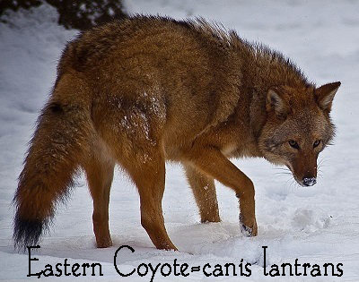
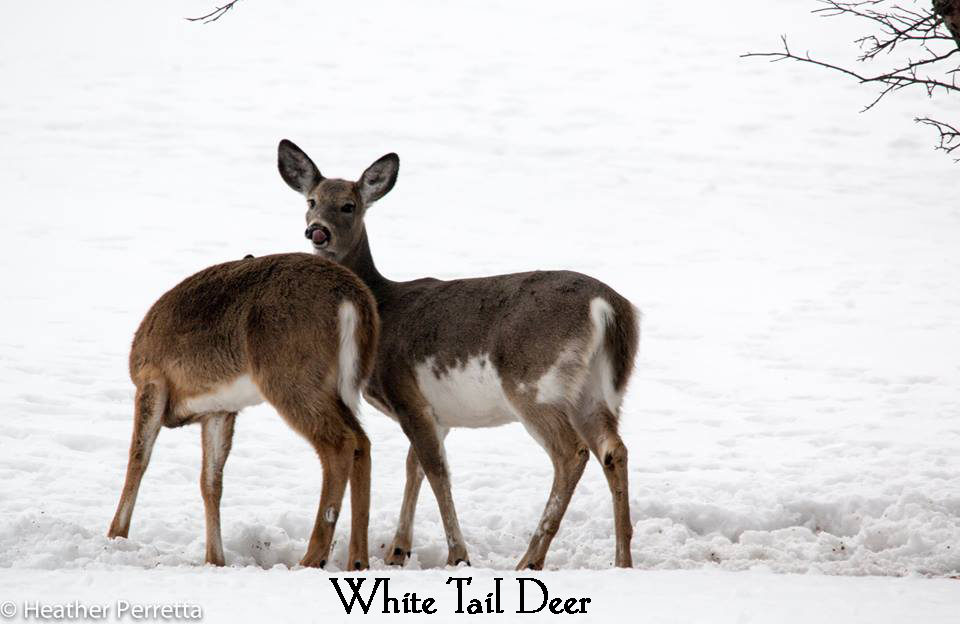
Mammals-White tail deer, Eastern Coyote/Brush wolf, Beaver, Black Bear, Raccoon, Fishers, Bobcat, Mink
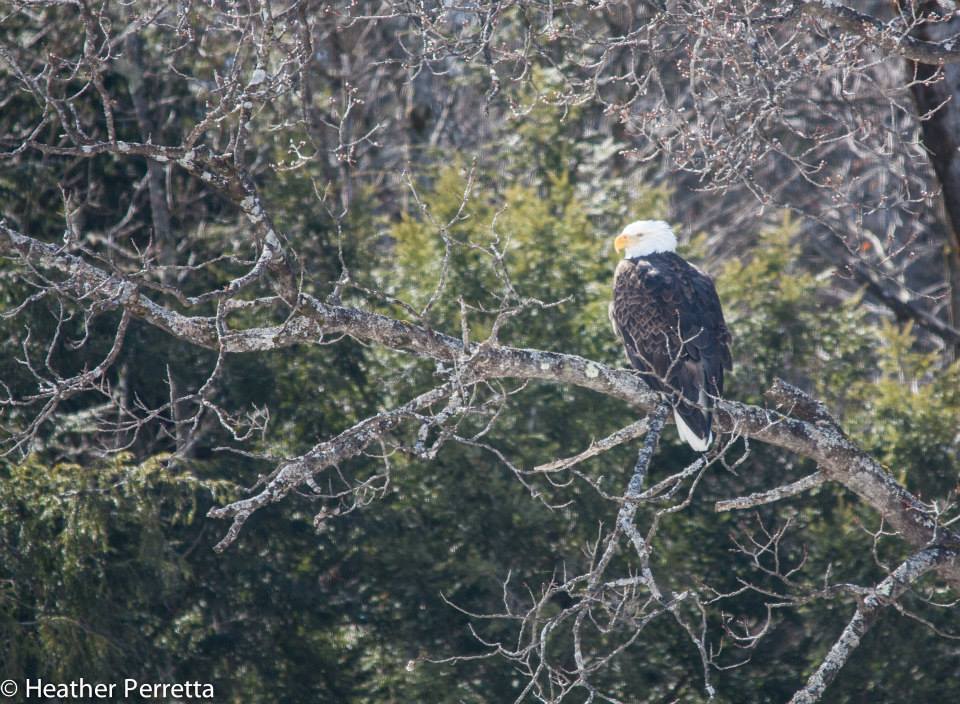
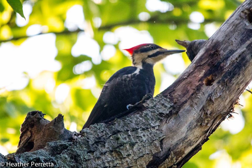
Birds-Eagle, Hawks, Pileated Woodpecker, Bluebirds, Crows, Ravens, Falcons, Blue Heron
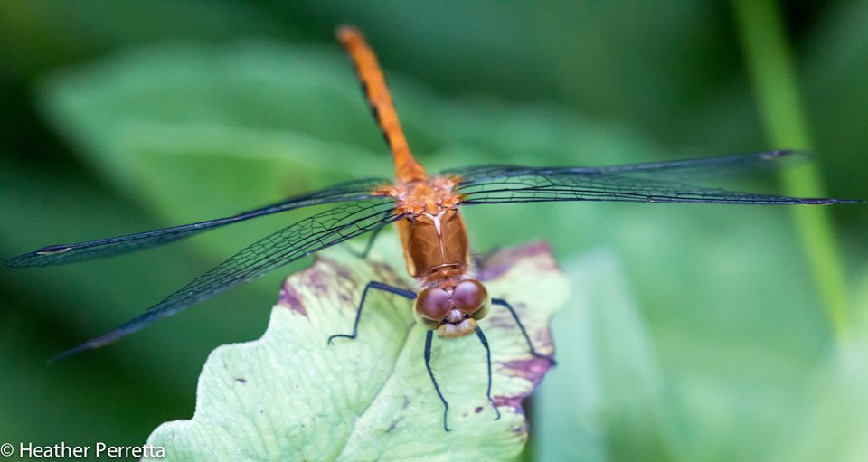
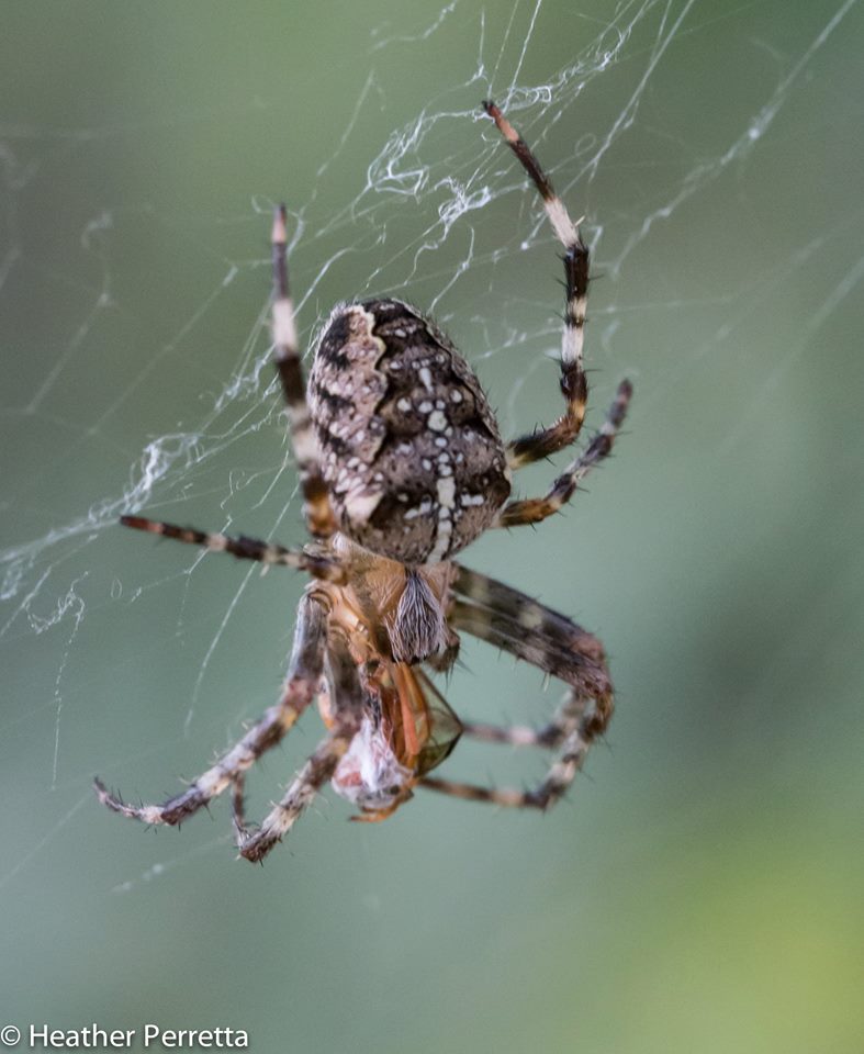
Insects and Spiders-Monarch Butterfly, Deer ticks, Black Flies, Orb Weavers
Fish-Trout, crayfish, Bass, Northern Pike
Reptiles-salamanders, snapping turtles, grass snakes, milk snakes
Plants
• Trees-White Pine, Maples, Yellow Birch, Black Cherry, Hawthorne, American Beech, Elm, Ash
• Shrubs-Elderbush, Hobblebush, High-bush Cranberry, Barberry,
• Edible-Leeks, Cattails, Groundnut, Wintercress, Blackberries, Raspberries
Medicinal Plants
1. Roots-Burdock, Yellowdock, Dandelion, Angelica
2. Leaves-Nettles, Mugwort, Motherwort, Dandelion, Chickweed
3. Flowers-St. Johnswort, Elder blossom, Red Clover
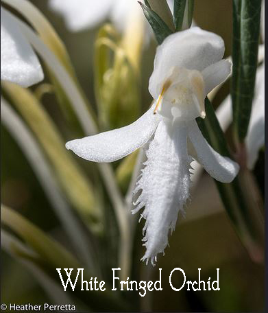
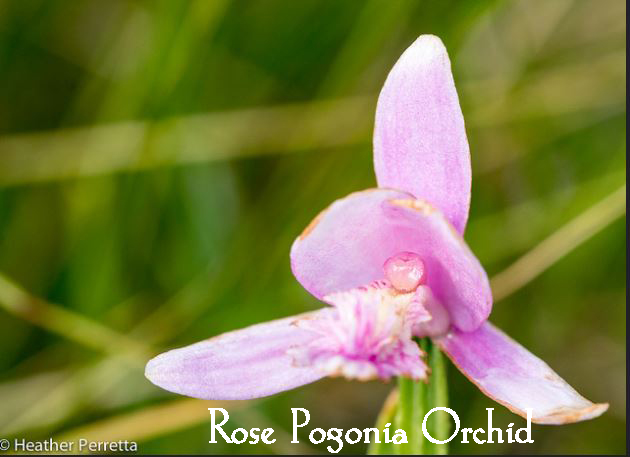
Native species-Trillium, American Ginseng, Blue Cohosh, Wild Ginger, Bloodroot, Wild Sarsparilla, Ghost Pipe, Orchids
European species-Burdock, Queen Annes Lace, St. Johnswort, Mugwort, Coltsfoot

Plants from other lands-Japanese Knotweed, Japanese Honeysuckle
Sacred Plants and Trees- White Pine was sacred to the Haudenosaunee and considered the “Great Tree of Peace”
Mugwort-Artemisia vulgaris species sacred in Europe and used for protection and healing
White Cedar(Thuja occidentalis) native to the Northeast of North America and used past and present ceremonial and as medicine
Fungi-Reishi mushrooms(Ganoderma Tsugae), Turkey Tails, Amanita flavoconia, Puff balls, Chaga

Human Settlement
Ancient-First people inhabited area 9,000 years ago-possibly the Lamoka people
Pre-Colonial-Haudenosaunee(Iroquois) , the Kanien'kehá:ka(Mohawk) people of the(Iroquois) confederacy inhabited the Kuyahoora valley for all of documented history until colonial invasion.. The Kanien'kehá:ka means the People of the Place of the Flint. Flint, as it turns out, is a form of quartz and although it is commonly thought that the Mohawks were named because they were Flint knappers, no Flint quarries have been found in the Mohawk Valley.
"They were known to themselves and to the other Iroquois nations as the Kanyenkehaka, the people of Kanyenke (also spelled Ganienkeh). This has usually been translated "Place of the Flint," but the flint (or more properly chert) sources in Mohawk country were not particularly sought after. More important were the clear quartz crystals now called Herkimer diamonds, which could be quarried in a few local mines and abound on Mohawk village sites. These were highly valued by Iroquois and other nations. Kanyenke was more likely "Place of the Crystals." Crystals were symbolically important as amulets of success, health, and long life, artifacts more likely to inspire a name than a second-rate chert. The Mohawks were the main suppliers of quartz crystals up to 1614. After that they became primary middlemen for the Dutch glass beads that replaced them." Dean Snow, The Iroquois
Colonial-Dutch, German, English, Irish
Industrial-The industrial revolution brought an influx of immigrants from other parts of Europe primarily Italy, Germany and Poland. They came to work the many mills that had been built along the major waterways.
Current-predominately white of various European descent although the Haudenosaunee and their confederacy continue to hold a strong and stable presence and energy in New York State with many activists from their central communities and elsewhere working towards bringing the messages of peace, balanced social structure and ecological law into the mainstream. The Onondaga Nation of the Iroquois is currently promoting their “Two-Row Wampum Campaign” in partnership with their friends and neighbors of all races and cultural backgrounds near and far. This is an effort to establish harmonious co-existence based on a treaty that was made with Dutch immigrants 400 years ago stating that they would all live peacefully. http://honorthetworow.org/
Our nearest city of Utica is an extremely diverse community as it is the fourth largest refugee center in the United States and is home to refugees from all over the world including Bosnian, Somolia, Vietnam, Sudan, Burma, Bhutan, Afghanistan, Russia, and Belarus.
Sacred Sites
Auriesville shrine-A Roman Catholic shrine that was once the Mohawk village called Ossernenon. Kateri Tekakwitha(below) was born there.
Kateri National Shrine, Fonda, NY- the shrine of Saint Kateri Tekakwitha Mohawk woman who became the first Christian saint in the United States and Canada
Herkimer Diamonds and Ace of Diamonds-Herkimer crystal mines where hundreds of people visit every year to excavate these precious healing gems.
Occupations-Farmers, construction workers, teachers, prison guards, small businesses
Primary form of healthcare-conventional medicine
Air

Weather patterns
Rainfall-about 42 inches a year
Growing season-from May-Sept
Snowfall-89 inches a year
Climate-temperate rainforest
Temperature Range-20 below zero to 95 degrees(Fahrenheit)
Weather pattern change in the last 50 years-I haven’t found any official data but everyone who lives here says that if you were born less than 30 years ago you don’t remember a real winter
Constellations
Winter sky-Big Dipper, Cassiopeia, Little dipper,Perseus Orion
Summer-Andromeda, Big Dipper, Little dipper, Pegasus
Water

Watershed-West Canada Creek which is really a river. It’s 76 miles long and the largest tributary to the Mohawk River. Watershed is 569 square miles. Waterflow up to 1500 cubic feet per second. The West Canada is dammed at Hinckley Reservoir so water flow fluctuates
Household water source-Well
Bodies of water-West Canada Creek, Shed Brook, Mohawk River, Hinckley Lake
Last time there was a flood-There’s one almost every year
Water Quality Indicators: There has been much talk about the high level of pollution in the Kuyahoora Valley but water and soil tests have not proven it to be so. There are several wildlife indicators of a healthy environment Based on my direct observation. They are: Mayflies, Dragonflies, Crayfish, baby Trout in the tributaries, Eagles, American Ginseng and Usnea lichen. These all indicate moderate to good quality air,water, and soil. When I was growing up in the 1970’s there were many species that I had never seen that I witnessed return through time. I had spent a great deal of my life at my Grandparents outside of Old Forge. We never saw ducks or geese or many other small birds as a result of heavy spraying for black flies with the pesticide DDT. Since that was stopped, I have seen wildlife returning in abundance. I can remember the first time I saw a wild duck on the lake and how excited me and my brother were when a whole family came swimming by us. I saw my first bald eagle in my early thirties when one flew over my head while I was driving along the West Canada Creek. The biggest environmental issue that I am concerned with currently is the myriad of corn fields that are heavily sprayed with no buffer zones along the creek, although, apparently, water tests have not shown pesticides above normal levels(as if there is a normal pesticide level).
Fire
Heat source-Wood Stove
Energy source- Power grid
Waste disposal-compost and garbage truck that takes garbage to a landfill and recyclables to the recycling center.
Last time there was a forest fire-None that I am aware of. We have major issues with flooding and mold. It's very rarely dry here.
Shortest Day of the year-9 hours, 33 minutes
Longest day of the year-15 hours and 19 minutes
Resources:
****All Photos except for 'The Kuyhoora Valley and the Coyote are by Heather Perretta: http://heatherperretta.com/
Coyote photo from wiki commons.Attribution: http://www.ForestWander.com
Thank you to Heather Perretta for most of these incredible photos of our bioregion. Heather is a local naturalist and photographer with a great attunement to the land. You can see more of her photos at her blog: The Backyard Naturalist and find her on Facebook: https://www.facebook.com/backyardnaturalist
Artist and Author Sarah Anne Lawless: http://sarahannelawless.com/
HOME! A Bioregional Reader by Van Andruss, Christopher Plant, Judith Plant and Eleanor Wright
Kuyahoora: Discovering the West Canada Valley by M. Paul Keesler
Mohawk: Discovering the Valley of the Crystals by M. Paul Keesler